OS Terrain 50

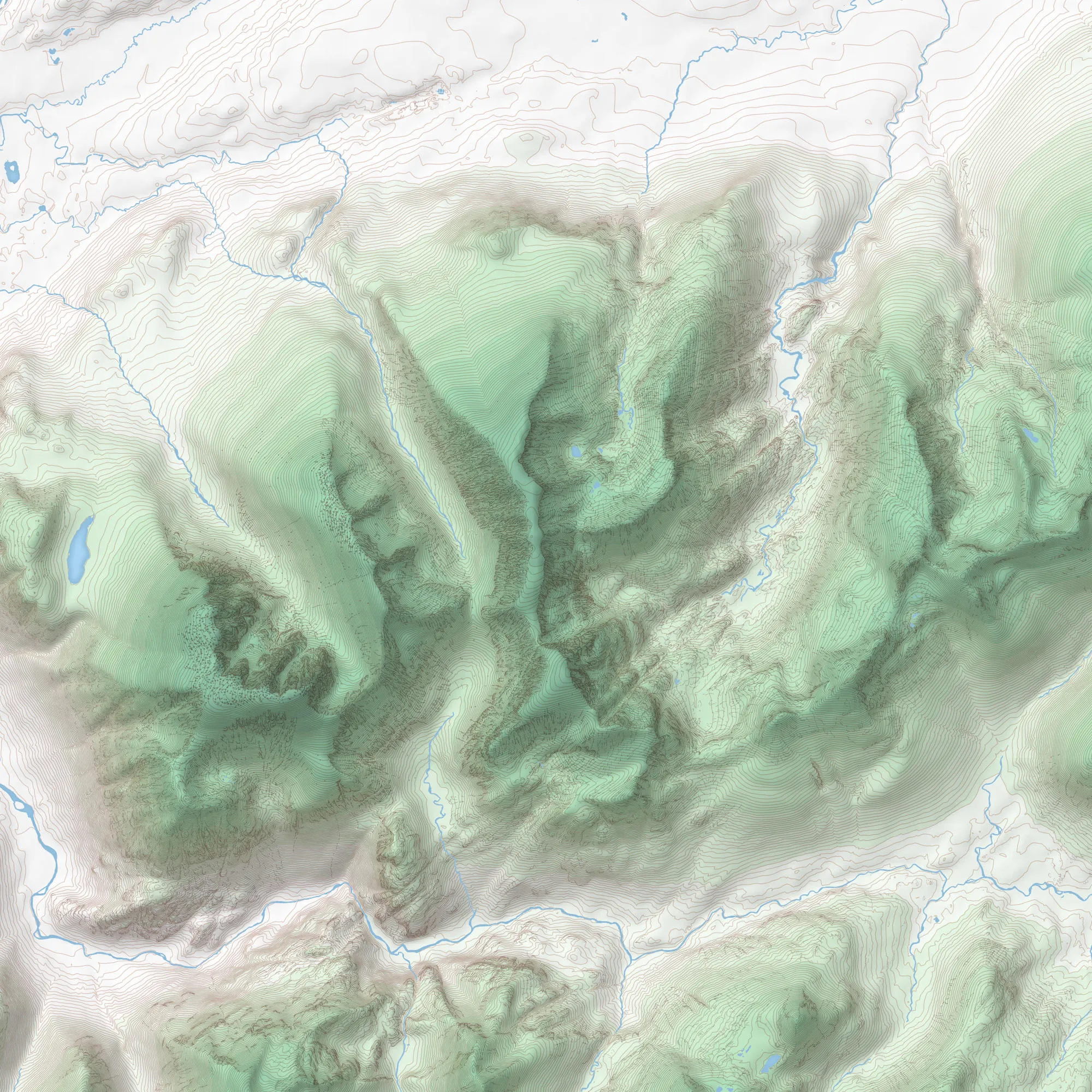
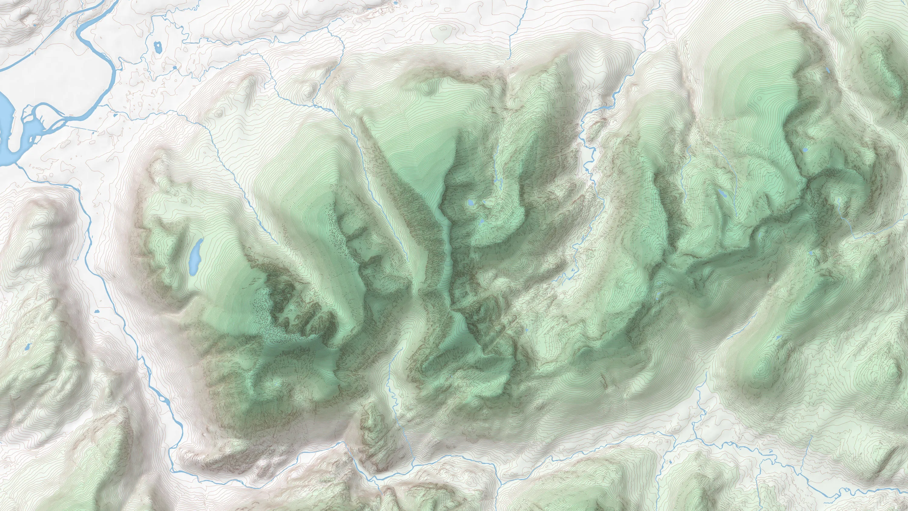
OS Terrain® 50 is an open height dataset of contours with spot heights, breaklines, coastline, lakes, ridges and formlines for Great Britain.

  • Height and imagery
  • Download
  • OS OpenData Plan (FREE)
  • Public Sector Plan
  • Premium Plan
  • Energy & Infrastructure Plan

This product is updated annually

Representation of data provided

What OS Terrain 50 provides you with

Model wind direction and lines of sight

Make better decisions about where to locate wind turbines and mobile phone masts. OS Terrain 50 lets you model wind direction and lines of sight at your desk, meaning fewer site visits.

Plan landscape defences

Get the bigger picture about flood risk, soil erosion and pollution. By showing steep hillside gradients, OS Terrain 50 helps you plan flood defences and safeguard the landscape.

More engaging maps

With the contours version of OS Terrain 50, you can shade in hills to show their height. This extra sense of depth is ideal for walking maps and apps.

Surface model entire landscapes

Get an accurate, uncluttered view of the terrain with the grid version of OS Terrain 50. Its 50 metre post spacing gives you a surface model of the entire landscape, including major roads, large lakes and estuaries.

Take account of tides

The contours dataset also includes mean high and low water boundaries.

OS Terrain 50

Technical information

Specifications

Use cases

OS Terrain 50 can be used in conjunction with various Ordnance Survey digital products for analytical, modelling, planning and visual purposes.

These uses enable customers to undertake the following:

  • Asset/site management
  • Signal propagation
  • Environmental analysis
  • High-level development
  • Geological analysis
  • Line of sight planning
  • View shed modelling
  • Using the product as a visual aid
Access
  • Download
Data theme
  • Height
Data structure
Vector - DTM grid, Contour lines
Coverage
Great Britain
Scale
1:50 000
Format
  • GML 3.2 Simple Features
  • ASCII (DTM grid)
  • ESRI Shapefile
  • Vector Tiles
  • GeoPackage
Ordering area
  • All of Great Britain
Publication months
  • July
OS Data Hub plan
  • OS OpenData Plan (FREE)
  • Public Sector Plan
  • Premium Plan
  • Energy & Infrastructure Plan

Documents and Support

Getting started guides

  • OS Terrain 50 - Overview
    The overview introduces the product and gives context for all users. It highlights key features, provides examples of potential uses for the product and lists details like file sizes, supply formats, etc.
    pdf
    v1.5
    374 kb
    March 16, 2022
  • Getting started with GeoPackage
    This guide helps you to get started using GeoPackage - a lightweight format that can contain large amounts of complex data in a single, easy to distribute and ready to use file.
    pdf
    v2
    1.11 mb
    September 30, 2021

Technical specification

  • OS Terrain 50 - Technical specification
    The technical specification provides detailed technical information about the product. It is targeted at technical users and software developers.
    pdf
    v2.0
    592 kb
    July 17, 2023

Supporting documents

OS Terrain 50

Get this product

What you get

Key features
  • Model wind direction and lines of sight
  • Plan landscape defences
  • More engaging maps
  • Surface model entire landscapes
  • Take account of tides
Category
Height and imagery
Access
  • Download
Data structure
Vector - DTM grid, Contour lines
Update frequency
Annually

How to access

OS OpenData is free

Ready to get started with OS data?

Take the next step by signing up to the OS Data Hub and create your first project today.
Sign up to the OS Data Hub

Get this product

Access for free and benefit from using OS data

Get help

Further support

For further help about how our data can transform your organisation, contact us today

Contact us